
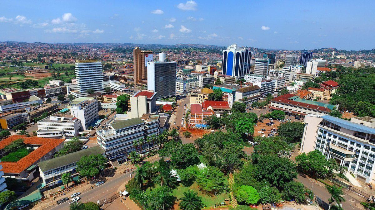
It is an open secret that the biggest part of Kampala plots, homes, buildings and streets are likened to being unknown. Reason? The absence of a naming system, efficient and organised enough to give proper directions, resulting in the use of natural landmarks to guide traveling and mapping. Most properties are lightly identified by the buildings next to them, stones or hills on which they lie, churches and mosques next to them, and even boda boda stages.
Not until recently, two years ago, when Kampala Capital City Authority (KCCA) started on numbering properties, streets and installing road signage within the city, navigation was at one’s risk. Not even Google Maps could save you! The street/physical addressing system is targeted at making it possible for easy identity of locations as well as to assign addresses using a system of maps and signs that give the numbers or names of streets and buildings.
This particular project within Kampala is being undertaken by Technology Associates (TA) – a renown IT service delivery company, and once it is complete in a few months, Kampala will have made it to the rank of a smart city, and will stand to benefit from being an organised ultra-modern metropolis.

The system involves picking coordinates and other property attributes and uploading them onto the digital system using Geographical Positioning System (GPS) which picks coordinates and feed them into their system. The integrated solution includes property, document management and smart permits (SP) modules and with this people will be able to apply for documents, advertising, construction permits and leases from the KCCA.
Within KCCA, the Directorate of Physical Planning is spearheading the implementation of the City Address Model and Mass Property Valuation System (CAMPV) under the second Kampala Institutional and Infrastructure Development Project (KIIDPII), funded by the World Bank.
Mr Peter Kaujju, the head Public and Corporate Affairs at KCCA, says the project is ensuring that houses are being numbered, roads named and signage installed. This will make revenues from the city property including ground rents and taxes, parking and advertising hoardings visible, easily controlled and collections manageable. Additionally, the issuance of development permits will be controlled and will be automated and online.
This ongoing project also digitally captures the numbered and named buildings and streets. It will go a long way in reducing the disorder and disorganization which has been costing the city and country in a number of ways
Status of the Project
Mr Kaujju explains that Nakawa Division has fully complied with House numbering, with a 100 per cent of its targeted 75,300 homes in the division numbered. Central Division has 13,759 houses numbered out of the 16,000 projection. 71,874 houses out of 79,000 have been numbered in Makindye (90.98 per cent), in Kawempe 81.90 per cent have been numbered (52,417 out of 64,000). Only Lubaga Division has not met 50 per cent with only 30,914 numbered out of 80,000 projected houses.
He says road naming has recorded good progress in Kawempe where 50.2 per cent of the 2,533 roads in the division have been named, and at least 2,599 street signage faces have been installed on 1,742 sites. Additionally, a total of 10,273 Faces were mapped and 5,267 Sites identified for signage. KCCA has also installed 39 tourism signages.
What does Technology Associates do?
KCCA contracted TA, an ICT Group with a solid and well established presence in Kenya, Uganda, Tanzania, Rwanda, Malawi and UAE. The frim is the region’s first ISO 9002 and ISO 27001 IT company, and it has been delivering quality IT solutions to East Africa’s leading corporate, multinationals and the government sectors through partnerships with the world’s leading IT vendors that include Oracle, Dell EMC, HP, NetApp, VMWare, Diebold Nixdorf, Veridos and many More.
Mr Girisch Nair, Chairman of Technology Associates Group who are implementing the technology platform together with India based Innowave IT Infrastructure Ltd, says the platform includes a Geographical Information System (GIS) that will work as an integrated solution for CAM to manage property taxes, street naming and identification in the city.
The system will also be time-saving since people will not have move to KCCA officers every now and then applying for documents. All they have to do is access the single window system, a web portal, submit their application and wait for the quick response.
Mr Nair adds that the project will also promote transparency between citizens and KCCA. For instance, if people want to know anything about their property, application status or anything, they don’t have to visit KCCA offices, they could just check on the web portal to get all the information they want. This will also increase the authority’s revenue since they will be able to monitor property to ascertain their status.
Once the project is complete, Mr Nair says they will embark on training KCCA staff and citizens to ensure that they get proper knowledge on how to use the system.
Benefits of a smart city
In a safe and smart city, the inter-linking of public and private networks for more efficient and effective security management is inevitable. The entire project gives the government access to new tools so as to have a wider outlook of the security of any area at any given time. It will make it easy for government agencies to follow up on various sectors.
The biggest beneficiaries will be KCCA, URA, and other agencies which will be able to tell the location of the property and the owner because every street, road, and building will be identified with a unique identifying number anyone can refer to. Another beneficiary is the Uganda Postal Services who should use the model to roll out its services across the country. Uganda has more than 30 licensed postal and courier service providers, most struggling for lack of an organized city.